Spatial Design Thinking in Development Discourse: A Master-Workshop

Instructor: Dr. Khushdeep MalhotraLanguage: English

About the course

Explore the foundational concepts of spatial thinking and Geographic Information Systems (GIS) in this two-day workshop. This workshop is tailored for beginners to intermediate learners, offering a balance of theoretical insights and practical applications to empower social researchers in incorporating spatial analysis into their work.

What Makes Us Different

  • Attend a dynamic one weekend workshop facilitated by an accomplished expert.

  • Join us for an on-campus workshop where you can enhance your skills and gain valuable insights. Don't miss the opportunity to meet like-minded people and expand your network.
  • Study in a small cohort with a specialist professor who will engage with unique pedagogy.

What you’ll learn

Meaning of Spatial

Just starting out? No need to worry. Let’s take the first step together.

What is GIS?

A brief introduction to Geographic Information System.

Basics of Mapping

From types of maps to creating maps on QGIS, this course covers it all!

Working with Data

Having covered all bases, this section tells us how we can make practical use of our knowledge.

MODE

Hybrid, Participants from Delhi NCR can join in person

Online classes available

TIME

On 6th and 7th April, 2024

LOCATION

OP Jindal Global University, Sonipat, Haryana- 131001

Workshop Outline

Day one

Session 1: Why think spatially? (10:00-11:10 am)

  • A brief introduction to theories of the spatial
  • What is spatial thinking?
  • Asking spatial research questions
  • Ethics of mapping
Session 2: Mapping the ‘Field’ (11:30-12:00 pm)

  • Collecting and processing spatial data
  • Types of GIS Data
  • Data management and storage
  • Field exercise
Session 3:  Introduction to GIS (and web mapping if possible) (2:00-3:00 pm)
  • Introduction to cartographic principles
            i. Types of maps
            ii. Data visualization
  • What is QGIS?
  • Importing data into QGIS
  • Creating a map in QGIS


Day two

Session 4: Working with data (Part I) (10:30am - 12:30 pm)

  • Identifying, downloading and processing spatial data (census, public health, climate change, mobility or any other datasets) Visualizing spatial data in QGIS.
  • Exploring patterns from a subset of spatial data.
Session 5:  Working with data (Part II) (2:00-5:00 pm)
  • Basics of map-making/geoprocessing.
         i. Performing queries, selections and joins (Spatial and Non-spatial)
         ii. Basic statistics
         iii. Intermediate level analysis
  • Creating choropleth maps and heatmaps
  • Buffer and Nearest neighbor analysis
  • Mapping spatial change over time


  • Qualitative mapping
              i. Map annotations
             ii. Multimedia (images/videos)


Syllabus


Meet Our Instructor

Dr. Khushdeep Malhotra 

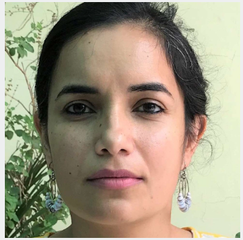
Principal Research Scientist, IIT D

With a PhD in Geography and Urban Studies from Temple University, she works on experiences of home-making and belonging among the Kashmiri Sikh community in the context of precarity and militarization in Kashmir Valley. At IIT-Delhi, she is tasked with understanding young women's on-campus experiences and their implications for women's retention in STEM, using 'affective' GIS to tell data-driven stories. 

Prior to the PhD, Dr. Kaur worked in Public Health, where she used GIS and other mapping technologies to understand health disparities among historcally excluded communities in the US.

Launch your GraphyLaunch your Graphy
100K+ creators trust Graphy to teach online
Prayaas 2024 Privacy policy Terms of use Contact us Refund policy